Salt Domes of the Gulf Coast
SALT DOMES, NATURALLY OCCURING GEOLOGICAL formations, have attracted dramatic transformations. Though they exist in other parts of the USA, they are mostly found in the Gulf region of the southeast, where hundreds of them are scattered in a great arc from Texas to Louisiana. Many linger unmolested, deep underground. Others approach the surface (or the surface erodes down to them), revealing themselves and the opportunities they offer. Others have been sought out, detected by subsurface imaging technologies, and been bored and excavated remotely, while remaining thousands of feet below the surface.
To understand how salt domes form, imagine a lava lamp, where a less dense fluid moves upward within a more dense one, forming a bulbous bulge, like a giant raindrop falling upwards, in slow motion. In geology, this occurs when subsurface pressure forces less dense material, like salt, upwards through a crack in strata, forming an intrusive column of the material, surrounded by rock. The salt domes of the Gulf are pressed upwards from a mother layer of bedded salt much deeper underground.
Continuously forming in geologic time, these underground columnar bubbles can be thousands of feet across, and their heights can extend for miles. When the tops of these structures get within range of human access, at least a few thousand feet below the surface, they become useful to us.
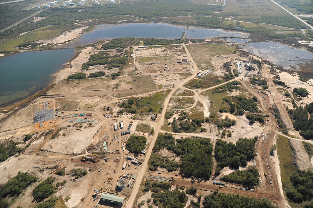
When they near the surface, salt domes can form a bulge that is perceptible as a low, round hill, often the only topography in the flat marshlands of the Gulf. With erosion they can breach the surface, and become a circular mix of salty earth and water, a subtle topographically anomalous zone, covered over by whatever foliage is indigenous to the region. Generally the surface features of the salt domes in the Gulf are contained within a circle a mile or two in diameter.
A significant effect of these monolithic geologic intrusions, especially in the Gulf, is that oil can flow through the pierced rock layers, collecting in pools around the edges of the formations. This was quickly discovered at Spindletop—the discovery well of the Texas oil boom. After that, salt domes were sought out and drilled out, the low hanging fruit of the oil patch.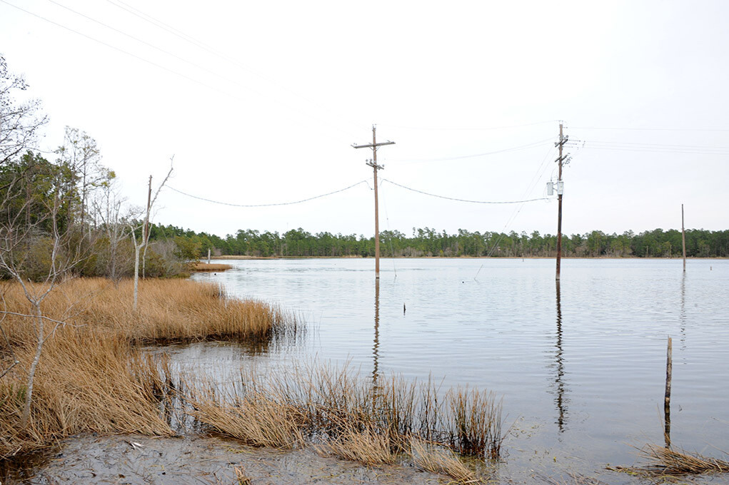 The result is that many salt dome landscapes are beat-up old oil fields with spent wells, old collection ponds, pipelines and machinery. With all that extraction, they often deflate and subside, forming ring-like lakes around the edge of the dome. Waste products from the oil industry are often disposed of by injecting them into the ground through spent oil wells. In this way salt domes become waste sites below the surface as well.
The salt is hardy though, and drillers have found another way to use these domes, now linked by pipelines and roads. Injecting water into them through a drilled hole dissolves the salt. Using the force of the injected water to push the saltwater out another drilled hole leaves a watery cavity inside the salt. This is called solution mining, or salt cavern leaching, and it leaves a hole that can be filled with anything you want to put in there. And around here, that means, mostly, natural and petroleum gas, which is usually found or produced with oil products, but often has to be vented or burned off if it doesn’t have a way to get to market immediately. Unless you have a way to store it.
Petroleum gas (mostly propane and butane produced in large quantities as a byproduct of refining, and a major source of heating energy) and natural gas (which is mostly methane, and is less processed, coming out of oil producing regions “naturally”) has been stored in salt domes in this way now for decades. The chambers are often around 1,500 feet tall and 300 feet wide, and their shape, vertical and irregular, resembles an upside-down carrot. A cavern like this can hold more fluid than a supertanker. Some domes have dozens of these cavities in them, clusters of upended buried carrot/supertankers. Most of the gas stored in these cavities is liquefied petroleum gas, (LPG) meaning it is compressed or chilled to the point where it becomes fluid, taking up a fraction of the volume that gas in gaseous form takes.
All over the country, natural gas is stored underground, especially in the Midwest and Northeast, where it is used in great quantity to heat homes in the winter. In these places it is usually pumped into storage in the ground itself, in wells drilled into rock formations, most often in depleted gas or oil fields, where gas was extracted already, and flows back into cracks and fissures and porous rock around the well. Some of it is not recovered when it is extracted; it gets lost in the rock, or leaked to the surface. This is a problem.
In salt domes, however, the sides of the salt cavities are dense, and all of what is put into them, comes out–plus a little extra salt, which has to be washed out of the gas. Over time, though, this little bit of salt, eroding from the walls of the cavity, slowly enlarges the cavity, sometimes by as much as 2% per year. As the cavities grow, they deform, sometimes developing unstable, bulbous shapes. Pieces can even break off inside the cavities, hitting pipes that, with erosion, have become suspended in open space. If you have too many cavities close together, full of pressurized gas, and the walls between them is thinning, this, too, can be a problem.
Given the range and volume of liquid and gas products produced in the Gulf region—more than half of the nation’s petrochemicals are produced there—the industry’s storage needs are large and diverse. Cavities in salt domes contain primarily liquefied petroleum gas products such as propane and butane, but also other hydrocarbons like ethane (a feedstock for ethylene), ethylene, and even gasoline and crude oil.
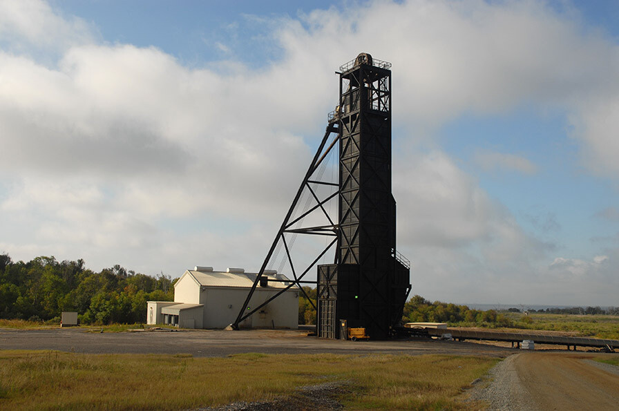 Salt domes also contain useful minerals themselves–salt, mostly, which is mined directly from them in excavated underground caverns, with trucks, bucket loaders and railcars, or by solution mining with water, which is then removed to produce dry salt. Most of the salt consumed with food comes from mined salt, some from the domes in the Gulf region, and from underground salt mines in the northeast, and elsewhere.
Many of the solution mining operations in salt domes in the Gulf, like those performed by the Texas Brine Company, are to supply liquid brine for industrial and chemical operations, such as water treatment in petrochemical plants, or for oil field operations, which use a lot of water. Brine is also a by-product of salt cavity formation, and is often stored in ponds or in cavities on site to push other stored fluids out of cavities.
 Sulphur, used in great quantities for fertilizers and other industrial products, can also be found at salt domes, generally in the caprock above the top of the dome. The once-dominant process for extracting sulphur, known as the Frasch Process, originated in the Gulf, and involves injecting steam into the ground to liquefy the sulphur and extract it as a fluid for processing. This involved a lot of wells, and a major heat plant to produce the steam.
Gulf coast salt domes were one of the leading sources of sulphur in the world through the middle of the 20th century, until a more economical way to produce it from natural gas and oil was developed. The last Gulf-area sulphur plant closed in 2000, though the remains of this brimstone industry can be found at many locations in the form of ponds, pools, foundations, and a deflated topography.
Though underground, and in a sense invisible, salt domes are a key feature for understanding the current patterns of development and transformation of the Gulf region. Their submerged monolithic simplicity belies the complexity that their existence engendered, through industry. ♦
