Bus Tour of Urban Crude
The popular creation myths of the city of Los Angeles are about water, movies, real estate, and oil. Many of these things, of course, overlap. Chinatown is the cinematic version of LA’s water myth, and is a film that did as much to modify the myth as the morsels of historical facts on which it was based. Early Hollywood has been addressed in countless films and other historic tales. Real estate too, in diffused ways. But what about oil? Might this subject be the other “Chinatown” of Los Angeles?

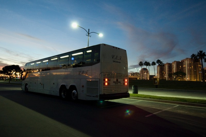
ON FRIDAY, DECEMBER 18, 2009 the Center embarked on a public day-long foray into the physical and cultural space of oil in Los Angeles, as part of the exhibit Urban Crude: The Oil Fields of the Los Angeles Basin. The attendees on the bus were the ones quickest on the draw. The tour sold out seven minutes after tickets became available.
The bus departed from the Center’s office in Culver City. By 9am, we were on the road headed west on Venice Boulevard, then up the 405 freeway just a few miles. In that time, CLUI director Matthew Coolidge, the main tour guide, provided some background and an introduction. The tour would have two principal parts, divided by location and lunch. The first part would look at oil extraction from the fields under the densest parts of Los Angeles, including Beverly Hills and downtown. The second part of the tour would look at the expansive and productive oil region of Signal Hill and Long Beach, where most of the oil in the basin now comes from.
Sawtelle Oil Field
We exit the 405 freeway at Wilshire Boulevard, and are soon at our first stop, a fenced enclosure next to the freeway, on the grounds of the vast campus of the Department of Veterans Affairs. This lot, full of interconnected tanks, pipes, valves, vents, and office trailers is the well site for the Sawtelle Oil Field, which lies ten thousand feet beneath us.
Sawtelle is the westernmost of a chain of eleven oil fields that extend for ten miles between here and downtown Los Angeles. These are the most urbanized producing oil fields in the nation, if not the world, collectively producing around two million barrels of crude every year, in and amidst the heart of Los Angeles. The Sawtelle Field’s share of that is around 185,000 barrels, all of which is extracted through wells inside this fenced compound, just 500 feet long and 200 feet wide. Currently 12 to 14 wells are active on site, with a few idle. Like nearly all wells in urban Los Angeles, they are drilled laterally, meaning they curve outward from the surface as they are drilled, extending like tentacles of an octopus from this centralized well head location. These legs are typically one to two miles long. This is what allows for the sizable fields underlying this part of the city to be accessed from just a few dozen surface sites, such as this.
The Sawtelle operation looks like other drill sites in the area, hidden in plain site, behind shrubbery, cement block walls, and a chain link fence. It is operated by Breitburn Energy, a local company which operates a number of other fields in the area, and which has been active in these urban fields since 1988. Breitburn was founded by two Stanford petroleum engineering students who bought up mature existing leases like this and redeveloped them using computer oil field modelling that had become suddenly achievable with the proliferation of personal computers. Though Breitburn has expanded now beyond California, they are still headquartered downtown, in the old Arco Tower.
We continue on, past the rows of soldiers’ identical tombstones at the Los Angeles National Cemetary. Then we head east on Wilshire into Westwood, passing the Federal Building, and then the headquarters tower for Kaufman and Broad Homes, one of the largest homebuilders in the nation and the source of wealth and power for Eli Broad, the principal art patron of Los Angeles.
After another block we pass the headquarters building of the Occidental Petroleum Company, the largest oil company still based in Los Angeles. Occidental is the fourth largest U.S. oil company, after ExxonMobil, Chevron, and ConocoPhillips. Founded by Armand Hammer, who helped open Libya up to oil and gas extraction, “Oxy” operates all over the Middle East, is the largest oil producer in Texas, and is the largest natural gas producer in California (due to its operations at Elk Hills, in Kern County). Its subsidiary, OxyChem, based in Texas, is one of the largest petrochemical companies in the nation, making more vinyls than just about anyone else. Among Oxy’s other assets are the THUMS operation in Long Beach, which we will see later; Love Canal, the famously contaminated site in New York state, which it acquired 26 years ago, long after the contamination occurred, as part of its purchase of Hooker Chemical; and, of course, the Hammer Museum, located at the base of the corporate tower.
Beverly Hills Oil Field
We soon pass into the Beverly Hills Oil Field, though of course there are no visible signs of doing so, as it is thousands of feet below us. This is a major field, trending east/west, from Century City to the Miracle Mile. It was discovered in 1900, and since then has produced 150 million barrels of oil. Today it produces around 850,000 barrels per year, from just three well sites, each among the most unusual urban oil well sites in the world. We will visit all three.

We arrive at the first one right on time, 10am, pull the bus into an alley off Olympic Boulevard, and get out to meet Sally English, operations supervisor for Venoco, which owns the site. This well site is a landmark, as a tall oil derrick tower looms above the walls of the site, covered in a tattered sound absorbing jacket that has been decorated with a floral design. The group gathers under a shed at the site for an informative briefing from Sally that involves maps showing the layers of ground between us and the oil, and other visual aids and specimens. She explains how the flowered tower moves on tracks over the couple dozen wells on site to work them over when need be. Otherwise the wells operate continuously, with electric pumps pulling the oil out of the ground at a rate of around 150,000 barrels per year. Four water injection wells push water, extracted with the oil, back into the ground, which helps to pressurize the field, forcing more oil (and water) out.
This site is most famous for the fact that it is on the grounds of Beverly Hills High School, and there have been suits filed against the company by former students claiming to have health problems from its emissions. These suits have been dismissed, despite the best efforts of the famous legal team of Ed Masry and Erin Brockovich. Venoco has owned this site since 1995, the only urban LA oil site owned by the company, which otherwise operates three ocean platforms off Santa Barbara and some fields in Northern California.

Back on the bus, we head into the anomalously epic corporate hotel modernist plaza development at the heart of Century City, along Boulevard of the Stars, where the new Annenberg Space for Photography abuts the huge new headquarters of the Creative Artist Agency, across from the Century Plaza Hotel. We then pass Fox Plaza, the tower featured in the mildly Ballard-esque movie Die Hard, located on the edge of the Fox Studios compound, which sits atop the Cheviot Hills Oil Field. Though there are several oil wells on the densely built lot, none are active anymore, and they are buried under the studio’s asphalt, basements, and soundstage slabs.
As we enter the most architectural portion of the tour, spread out over a few miles along Pico Boulevard, CLUI associate Ben Loescher takes over the narrative for a while. As a licensed architect and the primary researcher on the Center’s Urban Crude project, Loescher is better equipped than anybody to deal with the landscape ahead.
We turn left on Pico, at the leafy Rancho Park and Hillcrest Country Club. These two green areas on either side of Motor Avenue, contain the only two active well sites in the Cheviot Hills Oil Field. In each case, the cluster of wells is obscured by foliage in the middle of golf courses. Golf courses and oil fields are quite compatible, as the open space acts as a buffer against noise and smells reaching the community, and landscaping can easily hide separation tanks and other equipment.
Originally the derricks on site were jacketed in acoustical insulation designed by Hollywood sound stage engineers, and painted under the direction of architect Henry C. Burge to appear grass-green at ground level, with a gradient leading to sky-blue at the top so as to better harmonize with their pastoral golf course setting. As at most other sites, the fixed derricks have been replaced by truck-mounted mobile rigs that are brought in only when necessary.
Golf courses often become the redevelopment of choice at former industrial landscapes like oil fields, as their light development and surficial treatment does not require a reengineering of the ground. There are several other more dramatic cases of golf course/oil fields east of the city, such as in eastern Orange County, but those are out of range of our tour today. Here at Rancho Park and Hillcrest, a total of 57,500 barrels a year are extracted from the 18 non-golf holes on these courses. Though not a large amount compared to the 850,000 barrels produced by the neighboring Beverly Hills Oil Field, it still adds up to a couple million dollars a year in revenue. For a while Hillcrest Golf Club members received oil royalties instead of paying dues.
There are now alot of rules surrounding oil production in an urban environment, but of course it wasn’t always so. Until the 1920’s, Los Angeles wasn’t much of a city, so most oil discoveries and production initially occurred in rural or lightly developed areas, allowing oil production to proceed fairly freely. Regulation usually follows conflict, so as the population of Los Angeles seeped into oil producing areas, policies and rules grew accordingly. The cities of Beverly Hills, Santa Monica, Torrance, and the former City of Hollywood all banned new drilling within their boundaries.
Los Angeles occupied a cautious middle ground, moving first to prevent drillling on parcels of less than one acre, and then as the city grew (encroaching on established well sites and inhibiting the creation of new ones) it limited oil producers to no more than one well site per 40 acre lease.
Much of what we see today is the result of regulatory changes that happened in the 1950’s and ‘60’s, when Los Angeles enacted drilling ordinances that imposed further restrictions on producers—to control off-site sound, derricks had to be muffled—to limit odors, more gases had to be trapped—and to limit traffic, deliveries had to be made inside a fenced enclosure, and oil had to be removed by pipeline.
Continuing east on Pico, we reenter the Beverly Hills Oil Field and approach the second of its three unique active well sites, the Cardiff well site. It is visible some distance away, as it has one of the tallest structures around, though most people don’t realize what it is. The architecturally sheathed oil rig resembles the tower of a synagogue, as would be appropriate in this Jewish part of town (a recent article in an oil trade journal even mistakenly depicted an actual synagogue tower a few blocks away as the Cardiff oil tower). Originally built by Occidental Petroleum in 1966, the Cardiff tower was as tall as a ten-story building, and touted as the first “architecturally designed oil derrick.” The California Department of Oil and Gas noted that “the appearance of this drill site is much more attractive than that of the surrounding small business properties.” Mayor Sam Yorty attended the ribbon cutting, commenting that the structure was “an outstanding contribution to civic beauty.”
The tower has been rebuilt since then, but is not much different than it was. In 2000 Breitburn Energy, the owners of the site, enlarged the masonry wall around the drill site and rebuilt the derrick tower (which moves on tracks to service the well heads) in exchange for increased drilling rights. The tall walls that ring the two block long lot were built at the height of a single story building, and are heavily vegetated. Inside are 40 active and 12 idle wells and five water injection wells. The site produced 260,000 barrels of oil in 2008.
At the site, the bus turns left on Doheny Drive (suitably named after the discover of oil in Los Angeles) to make a loop around the site, stopping in the alley behind it for a closer look, then heads eastbound again on Pico, to the third and last well site in the Beverly Hills Field. This is the Packard well site, at Genessee Avenue. The group exits the bus here, and gathers at the front of what looks like an office building, but is actually an oil drilling lot with walls that are around 100 feet tall. Inside, a drill rig is free to move on tracks above the wells, completely obscured from the outside world.

When Standard Oil opened this facility in 1968 it was a show piece for the integration of oil production amidst the dense urban fabric. Visitors could enter the lobby, where displays described the operations at the site, and stairs led to a public viewing gallery, where they could watch the work on the well floor, which was open to the sky above in this roofless “building.”
Though it is still the most unusual and architectural oil well site in Los Angeles, and possibly the world, its current owners, the Houston-based oil company PXP, seem less than proud to show it off. The structure is locked and behind a locked fence. Plants and debris are encroaching on the lobby and the interpretive plaques, barely visible from the sidewalk through the dirty glass doors, are faded and water damaged. Like most urban oil sites, the companies that operate them seem to want the public to ignore them, and let them go about their business.
And business indeed continues, out of site, inside the Packard well site, where 51 oil and gas wells produced 491,000 barrels of oil and 763 million cubic feet of gas in 2008. 13 water injection wells reinjected some of the 5.7 million barrels of water that came out of the ground with the oil and gas. PXP operates oil platforms off the coast of California and in the Gulf of Mexico and oil fields in the San Joaquin Valley, Wyoming, Texas, and Oklahoma, as well as several other fields in Southern California, including the Baldwin Hills. The company’s total assets amount to more than $7.5 billion, and generated $2.4 billion in revenue in 2008.

After considering the implications of all this, the group heads back to the bus, and we continue down Pico. With more time to sit in traffic, we might have taken the bus up to the Beverly Center shopping mall, where PXP operates a fenced well site nestled in an indentation in the mall’s west flank. There, 54 wells dive into the Salt Lake Oil Field and into the adjacent San Vicente Field, producing more than 500,000 barrels per year.
Then, with more time, we might have headed west on Third Street to Farmers Market, where another drill site operated until recently. The site is now becoming a parking garage. Across the street, Ross Dress for Less blew up in 1985 when a tunnel boring machine working on the Red Line subway hit a volatile pocket of methane. Some blamed the pumping that was occurring at Farmer’s Market for increasing reservoir pressure that may have pushed the methane close to the surface. Although the oil operator denied responsibility, their insurer did settle out of court with injured parties for an undisclosed sum (and it was only a few years ago that the prohibition on the spending of federal funds on the subway extension was lifted, allowing work to continue in this volatile area).
On the other side of Park La Brea from Farmers Market are the La Brea Tar Pits, the most famous oily site in Los Angeles. Tar pits (or seeps) like the one at La Brea occur when petroleum works its way to the surface; once exposed to air, lighter volatile constituents evaporate, leaving the viscous asphalt behind, where it can entrap prehistoric animals and entertain school children. Tar from the La Brea site was used early in the region’s history for waterproofing native boats and roofing haciendas. It was a well enough regarded civic resource that the original land grant for the Rancho La Brea (Tar Ranch) stipulated that access to the tar not be restricted. Although it’s the largest, La Brea isn’t the only tar pit in town. Dozens of smaller tar seeps occur throughout the city. Some are permanent, while others spring up spontaneously in yards, driveways, and basements. It was these surface seeps that first drew people to dig, and then drill, for oil.
Las Cienegas Oil Field
But the LaBrea Tar Pits are easy to find, and most people have been there, so we don’t visit that either. Instead we continue down Pico and pull over at a nondescript cement slab, behind a fence, next to the LAPDs West Bureau, where some kind of building once stood. On closer inspection, the shapes of the slab show the features we have begun to recognize as the floor of an urban oil site, with the recessed cellar holding the remains of a battery of well heads, and the circular impressions where the separation and storage tanks once stood.
Indeed, this was the westernmost well site in the Las Cienegas Oil Field. It had 18 wells on it and shut down in 1993, but like many oil sites, it has expensive closure issues, and is awaiting enough of an incentive, and momentum, for the legal and bureaucratic process to remediate it. Or perhaps it will go back to being an oil site, as the four other well sites on the Las Cienegas Field are all still active, collectively producing around 500,000 barrels per year. Three of the four are operated by PXP (at Washington and 4th; Adams and Gramercy; and Jefferson and Van Buren). We head to the fourth, the easternmost one, at St. James and 23rd, near the 110 freeway, on the campus of Mount St. Mary’s Doheny Campus.
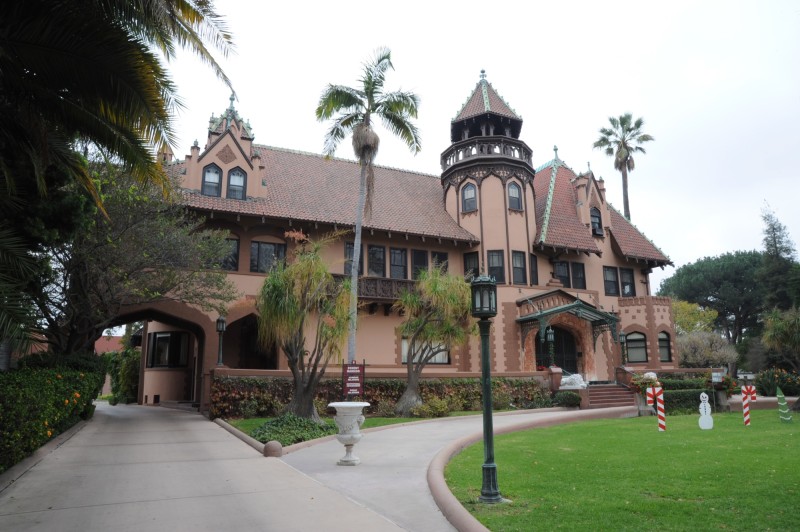
Edward Doheny lived at this site for most of his reign as Los Angeles’ first and biggest oil tycoon. Long after his death, his widow gave it to the Catholic Church, which turned it into a small college campus. Though the college has built up the site with new classroom and adminstration buildings, the compound that Doheny called Chester Place still has many of the qualities of the affluent exotic oasis it once was. The mansion he lived in is still there, and is the showpiece of the campus.
Doheny discovered oil in the city of Los Angeles, drilling its first well in 1892. If there was father of the industry here, it would be him. He developed a lot of Mexico’s oil industry as well, presciently selling the holdings before the industry was nationalized. His fortune came from building up companies such as the Pan American Oil Company, and selling them off as other companies grew.
He is also a tragic figure, who spent the last decade of his life defending himself against the bribery charges of the Teapot Dome Scandal. Though he was eventually acquitted, the trials and humiliations, compounded by the murder of his only son, crippled his spirit. Doheny died in 1935, after living here for 34 years.
The basic story of his life is recounted by the CLUI tour guide as the group walks down the middle of Chester Place and stops in front of the Doheny Mansion, now used as an administration and reception center for the college. But our final destination on campus awaits us. We walk down an alley behind a row of buildings, then up the stairwell of a parking garage, then gather on the upper deck for a view of the oil well site immediately below.
This is the 23rd Street site, the easternmost well cluster on the Las Cienegas Oil Field. It is owned by Allenco, a small oil company based out of Denver, which bought it from St. James Oil, with the hope of making it more productive. It is the smallest of the four active well sites on the field, pulling only around 16,000 barrels out a year through eight wells. Another 12 wells on site are idle.
This site was completely idle in the late 1990s, due to low oil prices, and calcification. Over time, oil wells can become plugged with mineral deposits, mostly left by the huge volumes of mineral rich water that flow through the wells, clogging the pores that seep into the drilled shaft and pipe. Well service companies, such as Halliburton and Schlumberger, are specialists in dealing with this problem, using acids, steam, explosives, and other techniques to get the oil flowing again. In this case, St. James began an acid treatment to unplug the wells, part of a project co-sponsored by the US Department of Energy. Hydrochloric and phosphoric acid was injected into five wells at the site, and by 2005, the wells were back online producing oil.

The workers on site look up at us as we watch them move around the oily lot. Though the manager had been invited to speak to us, he declined, preferring to continue his business behind the tall walls of the site, laid out before us from our perch like a schematic. In the near distance, a block away, the meandering roof and lofty palms of the Doheny Mansion can be seen. The span of the history and state of oil in Los Angeles, from the gritty urban lot to the gables of its barons, are visible in one vista.
Back on the bus, we head east on Adams, passing the cathedral-scale St. Vincent’s church, which Doheny paid to have built on the corner of his property in 1925 at the height of Teapot Dome scandal, and where his murdered son’s funeral was held in 1929, and later, his own, in 1935. Across from it is the similarly grand and ornate Spanish colonial style headquarters of the Automobile Club, whose role in the story of oil in Southern California should also be acknowledged, as without cars, there would be a lot more oil still in the ground. Oil was created to be consumed by cars, and cars were created to consume oil, a classic chicken and egg relationship.
Los Angeles Downtown Oil Field
We cross the 110 freeway, turn north on Hill Street, and enter the Los Angeles Downtown Oil Field. This relatively small field is an ovoid just over a mile wide, underlying the Staples Center, Convention Center, and the epic intersection of the 110 and 10 freeways. Only one well site remains active on the field, at 14th Place and Hill Street, and we pull over next to it. The site is similar to the other urban oil lots we’ve seen, half a small city block in size and behind a tall wall, though in this case its much more inner city in appearance.
The site, operated by the St. James Oil Company, has had some difficulties recently. Though there are 16 wells on the site, it is currently producing only around 5,800 barrels per year. Well stimulation efforts have included the injection of steam at high pressure to force the oil out. But, according to the city attorney’s office, the subterranean pressure forced oily ooze and smells out of the ground in a number of other places, including into storm drains, streets, and basements. On February 20, 2006, at the Iris Apartments two blocks away, the hot tar-like liquid seepage was significant enough that the residents of the 35 units in the building were evacuated for a week. Outside the door, Olive Street was so destabilized by the heated ooze that it had to be shut down for two months while the goo was siphoned out and the street resurfaced.
Back on the road into downtown we pass some of Los Angeles most remarkable architectural landmarks, such as the Herald Examiner building, part of William Randolph Hearst’s empire, designed by Julia Morgan, who also designed his castle at San Simeon. The Herald Examiner building has been shuttered since 1989, used principally as a film location (this is the fate of many buildings downtown, which helps sustain their limbo). Plans for its redevelopment include Thom Mayne/Morphosis-designed towers rising up from the site. We’ll see about that.
Turning left on Olympic we pass the urban twins of the Standard Oil Building and the Petroleum Building, the headquarters built by Doheny in 1925 as part of his 1920’s building boom. North on Figueroa, we point out the Arco Building, where Breitburn has its offices (Arco was absorbed by BP a few years ago), and Unocal’s former headquarters, shuttered when the company was acquired in the 1980s, which became a film location site, that evolved into the movie production facility LA Center Studios.
Los Angeles City Oil Field
North on Third Street, we enter the Los Angeles City Oil Field, which underlies the area on the north side of downtown, between Vermont Avenue and Dodger Stadium. This is the last of the belt of the 11 urban LA fields that we will look at, that started with the Sawtelle Field on the westside of Los Angeles. Hundreds of wells have been drilled into the Los Angeles City Oil Field over more than a century of production, starting with Doheny’s discovery well in 1892. This was the first urban oil field. It was close enough to downtown that residential development grew up with the oilfield and many old houses around here had pumpjacks in their front yards for decades.
This field is also notorious for the gases that come with the sulfury oil of the region, and the fear of their effects, on development. Methane alarms and vents can be seen in businesses and municipal structures built on top of LA’s oil fields – look for alarms on the walls at the Los Angeles Museum of Contemporary Art, or the Apple Store in the Grove, and for vents on the sidewalks around Park La Brea, where they emerge as painted steel poles out of the ground, like steampunk street sculpture. But the Los Angeles City Oil Field has Belmont.
Now open and called the Roybal Learning Center, Belmont ended up being a $400 million high school, the most expensive high school in USA. It took 15 years to build, and cost so much primarily because of uncertainties about oil field gases. Over the years of construction, demolition, redesign, politics, hearings, and demonstrations, construction was stalled so long that building codes changed, forcing more changes. Then there was the earthquake fault fears (oil collects along faultlines.) Finally opened a few years ago, the campus of 2,500 students is plumbed with an elaborate methane and hydrogen sulfide collection system that redirects the gas from under the building to tall vents outside, some of which double as light stanchions in the surrounding park and parking lots.

Because the Los Angeles City Field is the oldest field, and pumped the longest, it is now among the most played out. In fact, there is currently just one active well left. We go to it. The bus pulls in behind the Eglesia de Dios, la Esposa del Cordero, a storefront church on Alvarado, and we meet the operator of the well, Daniel Reyes of the Lesco Company, who has kindly agreed to meet us there to have a close look. He had been unaware that this was the last well in the LA City Field (a fact we had confirmed earlier, after a search conducted by the State Division of Oil and Gas). We are a few minutes early and his crew is just finishing touching up the paint for us. The group flows out of the bus, through the opened gate, and quickly fills the small lot. Resembling an animal in a zoo, the well is topped by a small, solitary pumpjack that produces around 1,000 barrels a year. The little pumpjack is even, in the words of one visitor, cute.

After many photos and questions for Daniel, the group gets back on the bus. We stop at the corner of Rockwood and Belmont to look at a cluster of pumpjacks in a bushy, scrappy, fenced lot, looking even more like animals in a zoo habitat. Though the pumps are permanently motionless now, this was an active well site a few years ago, the last of the old privately owned chock a block pumping operations in the LA City Field. Philip McAlmond owned this site, operating it as the McAlmond Oil Company, often staying in a trailer on the property to repel the vandals and thieves that plagued him. Originally it had just one well on it, but in 1983, he drilled nine more. They never produced what he had expected, or rather his tanks never filled as they should. He was convinced that the city was siphoning off his oil illegally, through underground pipelines that connected to the city’s Echo Park Swimming Pool property, at the bottom of the hill. He spent the last years of his life fighting the city, often calling on the FBI for help. He died last year, and the city is now finally moving in, over his dead body, to clean up his well site.
We head down the hill, past other well sites being dug up and remediated, and prepared for redevelopment. We pull into the parking lot of the Echo Park Swimming Pool, not because of McAlmond’s claims, but because this was the location of Ed Doheny’s discovery well. The well that started it all.
According to records of the State Division of Oil, Gas, and Geothermal Resources, (the agency that regulates the oil industry in California, and whose database locates and describes all of the more than 200,000 known wells in the state, operating and not), it was here, under the asphalt in the middle of the parking lot, where Doheny’s well was dug. We park the bus over the spot, and idle for a moment, and recreate the scene of the Discovery Well myth.
Doheny was an Irishman from Wisconsin, who came to Los Angeles at the age of 40, after failing to make it rich in the mines of New Mexico. He was nearly broke, with a wife and sick child. Staying in a boardinghouse downtown, legend has it he saw someone pushing a cart that had black gook in it, the tar (brea) that came out of the ground in a number of places in the region. He asked the man with the cart where it came from, and was told about a hole in Westlake Village. Inspired, Doheny set off to find it, and upon doing so learned that the pitch was used locally as a fuel in place of coal.
Doheny convinced his friend, Charles Canfield, to go into business with him, to help raise money to lease a three lot parcel with bubbling goo on it, the parcel right here. They started digging by hand in 1892 with a small crew, and reached a depth of 60 feet after 39 days of continuous work. Doheny’s sickly seven year old daughter dies at this point, and after the funeral, he comes back, and keeps digging. Months go by, digging by hand at the bottom of a goopy shaft. They reach 155 feet and are so sick from the fumes that they have to stop. They develop a crude drilling rig, which raises and lowers a steel rod that drills into the ground. The apparatus falls apart, collapsing into the hole. It takes weeks to extract it and put it back together, but they do so. After drilling another thirty feet, they hit a hard surface. Extracting the bit, they see it is coated in oil. The digging gives way to bailing, and the first oil well in Los Angeles is online, stimulating a regional boom.
This story is conveyed to the group on the bus, idling over the spot in the parking lot outside the pool, by reading the account in Doheny’s biography, The Dark Side of Fortune, by Margaret Leslie Davis. The bus then heads for the 110 freeway, passing the Belmont/Roybal school on the way, and heads southbound. As we transit the Los Angeles Basin, we are shifting places, scales, and time. Leaving the site of the first oil well in the basin, and the dwindling, sputtering old fields around it, we are moving to the newest and most developed oil fields in the basin, and some of the most productive fields in the nation.
In Transit
On the way we address the shift in time, scale, and form through a continued exploration of the legacy of Doheny. If the account of the miner coming to California and the details of his excavation of the discovery well seems familiar, that’s because it resembles the story as told in the film There Will Be Blood. This film, and Upton Sinclair’s novel, Oil, are both based, very loosely, on the Doheny story. There Will be Blood, Paul Thomas Anderson’s movie of 2007, comes as close as any film has to mythifying the foundation of oil in southern California. But it misses the mark, derailed into a father/son story, and a story of epic cruelty, and epic acting.
Doheny’s as yet untold cinematic story might make him out to be an empire builder, like his contemporary, William Mulholland. Both of these Irish men built big things, became legends in Los Angeles, and both had lives that ended in tragedy. For Mulholland it was the failure of the San Francisquito Dam, along the Los Angeles Aqueduct, which he had declared safe hours before it crumbled, washing away hundreds of people. For Doheny, it was the Teapot Dome scandal, but more—the fact that he had involved his son in it, and that this involvement caused his son’s murder. By most accounts, Doheny was a personable fellow, nothing like the exaggerated Noah Cross character of Mulholland in Chinatown, LA’s water myth. The scandal that brought shame on Doheny was perceived by many, especially him, as a simple misunderstanding of intention.
Teapot Dome is the name of a Wyoming oil field, one of two federally controlled fields kept mostly undeveloped in case of a sudden need for oil for national security purposes. Teapot Dome, the scandal, erupts under the presidency of Calvin Coolidge in 1923, after the death of President Harding. Oil man Harry Sinclair was accused of bribing President Harding’s Secretary of Interior, Albert Fall, to allow his company exclusive rights to drill for oil at that field. Ed Doheny was accused of the same thing, relating to the other federally controlled field, the much larger Elk Hills field in Kern County, California.
In Doheny’s case, the scandal is based on the interpretation of the relationship of two events, which nobody denies: Doheny gave a $100,000 loan to the secretary, Albert Fall, who was an old friend as well as the Secretary of the Interior, to buy a ranch. A few years later, Fall gives Doheny’s company exclusive access to Elk Hills, with an estimated $100 million in profits expected for Doheny. Was the loan a bribe or a friendly gesture? Did the first act beget the other? It didn’t help Doheny’s case that he had his son, Ned, personally go to Fall’s home in Washington DC to deliver the loan, in cash, in a bag.
This was a truly national scandal, about big business and government corruption. It went on and on, with federal hearings, local, civil, and criminal trials, all covered minutely in the national press over the following eight years.
During this period, Doheny tries to help his case through philanthropy, and builds churches and civic buildings in Los Angeles, like those we have seen today. Recognizing the power of film, he asks Cecil B. De Mille, over a lunch at Chester Place, if he would make a film, funded by Doheny, that tells his life’s story, which, he believed, was that of a patriotic hero, not a criminal. De Mille says no. Doheny pays a writer to write a favorable biography of Albert Fall, the interior secretary, but it is never published.
In 1927 Upton Sinclair publishes Oil, a book loosely based on Doheny’s life, up to that point, though the most dramatic part was yet to come. In 1928, after a few years of construction, Graystone Mansion is finished, the fanciest house south of San Simeon. Doheny builds it in Beverly Hills for his son Ned and his family. In 1929, Ned is shot dead in Graystone, evidently by his good friend and personal secretary, Hugh Plunkett, whose body is found next to him, dead of an apparently self-inflicted wound. A murder suicide. Ned shot by Hugh.
Hugh and Ned had been friends since boyhood. They went together to deliver the $100,000 in cash to Albert Fall, and so both were implicated in the scandal, and both were preparing to go to DC to testify. Hugh showed up at the mansion on the night of the murder in a disturbed state, according to staff at the house, but there were no witnesses to the shooting. The motive remains a mystery, and suggests some hidden truth, never uncovered. Doheny Sr. rushes to the house when called, and cradles his son’s body. The scene of the crime is tainted by the time the police arrive, and there are some discrepancies suggesting something else might have occurred, but the case is soon closed. The verdict is that an emotionally disturbed Hugh shot Ned, in an impulsive argument, then turned the gun on himself.
Doheny Sr. is crushed by this. He feels guilty for involving his son, and causing his death by the unstable and anxious Hugh. In a year he is, surprisingly, acquitted of bribery charges. The jury did not disagree with the fact that he gave $100,000 to Fall. Perhaps influenced by sympathy, they believed that his intent was not to gain favors, but to help a friend. Curiously, Albert Fall was convicted of receiving the bribe, even though Doheny was no longer accused of having offered one. Fall and Sinclair were both convicted.
Doheny is absolved of this scandal that occluded his life’s work, but it is too late, and he is a broken man. His wife, Estelle, builds a country house retreat near Santa Paula, in the hills north of Los Angeles, and Doheny lives out the five remaining years of his life, increasingly despondent, between there and Chester Place.
The mansion where the murder took place, Graystone, is still there and is unoccupied. It is owned by the City of Beverly Hills, used for events, and as a film location. Creepy films shot there include Death Becomes Her, Witches of Eastwick, Eraserhead, Dead Ringer, Winter Kills, and Dark Shadows. In the basement, there is a bowling alley (as there also was at Chester Place). It was used for the final scene in There Will be Blood (where, indeed, there is blood).
The conversation in the last scene of the film brings up an important point about oil production, one especially related to what we have seen today, and will see soon in some of its most impressive forms: lateral drilling, what the character Daniel Plainview emphatically describes to his nemesis Eli in the film as “Drainage!” This is the practice of drilling wells laterally to access oil underneath land beyond the drillsite. This practice is now the norm in the industry, and technology now enables drills to meander in all directions underground. Royalties are paid to every holder of the mineral rights through which it passes. But in the old days, it was practiced clandestinely. Derricks were sometimes wrapped in canvas to conceal the diagonal position of the drill stem, so that its direction was unknown, and royalties could be avoided.
“I . . . drink . . . your . . . milkshake!” Daniel Plainview explains to Eli in the film. This analogy, of the oil well as a straw curving over a table, linking mouth to drink, is a concept that the director of the film, Paul Thomas Anderson, claims to have lifted from the transcript of the federal testimony of Albert Fall during the Teapot Dome scandal. After the film comes out, this phrase becomes something of a cultural catch phrase for some reason, it strikes a chord. People mash it up with homemade videos on the internet, and Saturday Night Live does a skit “There Will Be Milkshakes for Old Men” (conflating two popular films of the time, both, curiously, made by idiosynchratic auteurs, and shot around the same time around Marfa, Texas). There Will Be Blood has an effect on the California Oil Myth, mutating elements of facts. Though it is no Chinatown.
Long Beach Oil Field
By this time, on the bus, we are getting close to our lunch stop, Curley’s Café, in Signal Hill, which offers standard American fare, including milkshakes. On the way we watch part of a short, locally made film, Signal Hill: Diamond in the Rough, which describes the community, and it’s history of oil. The bus pulls into the parking lot of the restaurant, which proudly sports two large and active pumpjacks. Inside, the place is decorated with old pictures of the oil industry of Signal Hill, site of one of the largest oil strikes in California, and today home of one of the most integrated urban oil fields in the world.
After lunch, Brady Barto, of Barto Enterprises, joins us on the bus to guide us through his city. Barto Enterprises is a real estate company which has developed much of modern Signal Hill, building housing areas and shopping centers on former oil production land. The company also owns the Signal Hill Oil Company, which owns and operates 95% of the 266 or so active oil wells in the city.
Signal Hill is the name of the community that surrounds the hill of the same name, which sits atop the Long Beach Oil Field. Signal Hill incorporated in 1924 to keep its oil revenue from being taxed by the city of Long Beach. Though it is relatively small in area, five miles long and a mile wide, it is the second most productive oil field in Los Angeles County, after the Wilmington Field, which we will see later. Nearly a billion barrels of oil have been extracted from this field since it was discovered in 1921. It still produces more than 1.5 million barrels per year from pumpjacks scattered throughout the community, connected by underground pipelines.
The tour makes a loop around town, passing the Starbucks drive-thru with a pumpjack, the McDonalds with a pumpjack, the Home Depot with several pumpjacks, and the cemetery, which, though it has no pumpjacks on it, is surrounded by pumpjacks and has laterally drilled wells underneath it. We also visit an active drill site, where a new well is being dug in an open area of chaotic old oil field land in the middle of town, a relic of how this area once looked.

We head up Skyline Drive, up the steep slope of Signal Hill, once referred to as Porcupine Hill when it was covered in oil derricks and not a single home. Now the derricks are gone and houses cover Signal Hill. But the wells are here too still, in small fenced lots in and amongst the housing, where individual electrically powered pumpjacks run off a dedicated high voltage grid operated by Signal Hill Oil, pumping their oily water through underground pipelines to off-site separation facilities. This reduces the footprint of well sites to only the pump.

We get off the bus at the top of Signal Hill, where a small park offers the region’s most complete view of the Los Angeles Basin: a panorama from downtown, to the Port, and southward down the coast. Helping us interpret this sweeping vista, from an oil point of view, is the petroleum geologist Don Clark, who meets us there, with maps and charts. He describes the earth’s subsurface structure here, the fault lines that trend northwest/southeast, and how the oil fields formed along them. He points out the various oil fields and oil refineries and reminds us how much oil remains to be had, especially here in Signal Hill. And he points out the distant artificial oil extraction islands off the coast of Long Beach, unique in the world. We are headed there next.
We leave the two urban oil experts on the top of their hill, pass the communication antenna spires rising from the high point of the hill, (today’s smoke signals), and curve around the far side in order to point out the field’s Discovery Well, still pumping at the corner of Temple and Hill Streets. Then south on Cherry Street all the way to the coast.
Wilmington Oil Field
Our last stop of the day is atop the Wilmington Oil Field, the Southland’s largest field in area and output. It is fifteen miles long and five miles wide, extending from Torrance to off Seal Beach, underlying most of the port of LA and Long Beach. The field has produced close to 3 billion barrels of oil since its discovery in 1932. In 1964 it became the first oil field in California to produce a billion barrels, the second one in the nation to have done so at that time. The field, discovered after most of the LA basin’s fields, was attacked with vigor. Within just a few years the land above the field was noticeably sinking.
By the 1940s, after only a decade of oil production, the land level was dropping to such an extent that buildings and roads cracked, oil well casings and pipelines sheared, and portions of the port flooded. Subsidence reached its peak, or pit, in the early 1950s, when the ground dropped by four feet in just two years.
The lowest point of the subsidence bowl was directly above the middle of the oil field, at the northern end of Terminal Island. Here the land was 29 feet lower than it had been before oil production began. The nearby Naval Ship Yard had suffered damage and flooding and the entire port itself was in danger. Drilling for oil was banned in Long Beach.
A program to inject water into the wells commenced, and soon the land stabilized and eventually began rising, as if inflated by air. The drilling ban was lifted in the early 1960s (though it remains in place to this day in the residential parts of town). Today an extensive network of water injection wells operates continuously, returning 105% of the volume of oil and water extracted from the field, in order to maintain equilibrium. Water injection will have to continue long after the oil is gone.
Of the 6,150 wells drilled into the oil field over the years, 1,300 remain active. By most estimates, the oil field is 90% depleted. But that depends on the price, and the value, of oil in the market and the cost of extraction. The western, land-based side of the field, where most of the early pumping occurred, still has pumpjacks peppered around the industrial and residential areas of Wilmington, and the port of Long Beach has batteries of wells on its land. But most of the oil from the field is extracted through wells that were drilled after 1963, on the (then) less tapped eastern end of the field, from four artificial islands known as THUMS.
The THUMS Long Beach Company, named for the original field contractors Texaco, Humble, Union, Mobil and Shell, was created to get at Long Beach’s oil with minimal disurbance to the city. The plan that was developed with the city was to position most of the wells offshore, on low-profile artificial land masses. The ten-acre islands were built quickly, starting in 1963, by barging rock from a quarry on Catalina Island. Rock was dumped in a linear fashion on the ocean floor, forming the outline of the four islands. Once a rectangular ring above the water level was attained, sand was then sucked from the adjacent ocean floor to fill the space inside the ring to above water level.
With the islands thus made, the most intense localized drilling operation in recent California history began. Eventually up to 300 wells were completed on each island, in a ring around their outer edge. Each well head sits a few feet from its neighbor in a trench, above which is a track that carries the moveable derrick. The city required that the two islands closest to shore have decorative walls which hide the industrial operations, and deflect their sound. These camouflaged features, which include lighted waterfalls and a building-like enclosure around the derrick, were designed by the architect Joseph Linesch, who also designed theme parks for Disney.
Some time after their completion in 1964, the islands were renamed after the first four astronauts to die in the Apollo program: Grissom, White, Chaffee, and Freeman. THUMS is now owned by Occidental Petroleum, and we are on our way to meet Bill MacFarland, a representative of the company.
Since we don’t have time to set foot on the islands, something that is sometimes possible for groups, but is a rather time consuming affair, we let our fellow California explorer, Huell Howser, tell us about his trip to the islands a few years ago, captured on film for his television show, California’s Gold.

As the video winds down, the bus pulls up at the Shoreline Marina and Yacht Club, and we walk out on the jetty next to the beach. The end of the jetty is a literal stone’s throw from the oil island that is closest to the shore. Bill MacFarland of THUMS Long Beach is waiting for us there. He hands us information and describes the history and operations of the islands.
The light of the day is fading, and the colored lighting of the ornamental wall, looming before us, mixes magically with the colors of the sunset. We bask in the soothing pallor of 1960s tropical exoticism, and walk back along the long Long Beach beach to the bus.

The shoreline of this city looks like the Grand Prix circuit that it is, all master planned engineered space, with big hotels and convention centers, family attractions, like the aquarium and the Queen Mary, and skybridges spanning the racetrack/shoreline boulevard, and linking the curvilinear shoreline promenades and marinas with these other features. We fly through it, and get on the Long Beach Freeway at its terminus.
On the way back along the 405 Freeway, we pass most of the major refineries in the Basin, some visible at a distance, others right next to the freeway: BP Carson with its big American flag; ConocoPhillips; ExxonMobil in Torrrance; and Chevron in El Segundo. These refineries are often used in cinema, most beautifully in the graphically enhanced opening scenes of Blade Runner. The short, elevated Highway 103 is flanked by refineries, and is often closed for filming futuristic or post apocalyptic car chases. The hyper industrialized spaces of refineries are often locations for cinematic denouement, where the conflict reaches its conclusion, just like the oil, which is being refined to its final state, gasoline.
We are watching one such scene on the bus as we pass the refinery at Torrance, the classic climactic ending of the film White Heat, which was filmed at the Torrance refinery. The clip shows the cops tracking the bad guys, who are hidden in an oil tanker truck, across town using a newfangled electronic radio location beacon gizmo. They are followed into the gates of a refinery, where after various shoot outs, James Cagney, playing a crazed crook, is cornered on the top of a tank farm. With no way out, he gleefully blows the whole thing up saying,“Top of the World, Ma!” This is a too rare gem of early petroleum noir, shot at the innocent beginnings of the postwar American boom.
In the waning light, we invisibly pass more oil fields, most nearly played out: Torrance, Dominguez, Lawndale, El Segundo. And further east Rosencrans, Santa Fe Springs, Montebello, Whittier, Brea Olinda. Not to mention the coastal Orange County fields of Seal Beach, Newport, and the giant Huntington Beach field, with its battery of hundreds of pumps in parallel rows along the coastal highway. In total there are 40 active oil fields in the Los Angeles Basin, the region south of the Santa Monica and San Gabriel mountains, from which 28 million barrels a year are extracted.
In 1925, almost half the world’s oil came from California, and most of that was from the Los Angeles Basin. Peak production wasn’t reached until 1969, when 133 million barrels were extracted, mostly out of THUMS. Though diminished, LA County today is the second most productive oil county in California. But it pales behind Kern.
Kern County, bordering the north side of Los Angeles County, includes the city of Bakersfield and the industrial agriculture of the southern San Joaquin Valley. But its western side, west of Interstate 5, is one of the most productive oil fields in the nation, historically, and to this day. About 180 million barrels per year come out of Kern County. Pipelines take the crude to refineries near San Francisco and to Los Angeles. 38% of the oil consumed in California is produced in California, and most of it comes from Kern County.
The other major domestic source of oil for the state are the oil fields of the North Slope of Alaska, a forty mile-wide swath along the Arctic Ocean, whose oil comes to us via the Alaska Pipeline and the 20,000 tanker trips that have been made up and down the west coast since the pipeline opened in the mid 1970s. But around half of what we consumer here, half of what we are burning in the bus on this trip, comes from other countries, mostly Saudi Arabia, Iraq, and Ecuador.
Though the Los Angeles Basin’s totals are still significant (certainly you would have a hard time sneezing at 28 million barrels of oil), it represents, proportionately, only 4% of the 665 million barrels of oil consumed in California every year. And, in fact very little of the basin’s oil is turned into gasoline, diesel, or jet fuel. LA’s oil is too thick and goopy to compete with lighter crudes from Kern, Alaska, and the Middle East, which are more productive to refine. Just about all of the crude extracted in LA is turned into asphalt to pave the roads.
We turn off the Interstate near LAX, and take the back way to Culver City, through the Baldwin Hills. The Baldwin Hills sit atop the Inglewood Oil Field, one of the most productive oil fields in the region. It was discovered in 1924, and since that time it has produced almost 400 million barrels of oil. When it was first developed, most of the surface above the field was owned by just five companies, so it was developed in a more orderly fashion than some of the chaotic fields, like Signal Hill and Huntington Beach, and reached peak production in just a year.
Operated for many years by Stocker Resources, it is now owned by PXP, out of Houston. The company keeps around 430 of the 1,200 wells in the hills pumping, extracting more than three million barrels of oil annually. It is the largest undeveloped (other than as an oilfield) area in urban Los Angeles County, and a veritable museum of Los Angeles’ landscape of the 1920s, when the city was still largely open land and was supplying a quarter of the world’s oil. The Baldwin Hills are an extemporaneous island, surrounded by an ocean of asphalt. They are a hole in the urban fabric: the largest open space west of the Puente Hills and south of the Santa Monica Mountains.
Its future is destined to be one of the major land use battles in Los Angeles. Proposals include a 1,400 acre Great Park, integrating the existing park lands at Kenneth Hahn State Park with a “land bridge” across La Cienega Boulevard, to the 950 acres of a restored, natural-esque, post-oil landscape with trails, recreation, and a wildlife habitat. In the meantime, and for the foreseeable future, supported by the rising value of oil, the Baldwin Hills will continue being what it has been since 1924: an oil field (currently generating over $100 million per year in oil and gas revenue for its owners).
The bus drives through the dark, wild oil lands on either side of La Cienega Boulevard, and down into the grid of the city, through the surreal crumbling new architecture of Erik Owen Moss-land, past the Metro construction corridor along National Boulevard (the urban train reclaiming the old railway right of way), past the closed car dealerships on Jefferson, being turned into digital effects and post production satellites for Sony Studios, and back, finally, to the Center’s offices to disembark, and to drive home. ♦